The Story
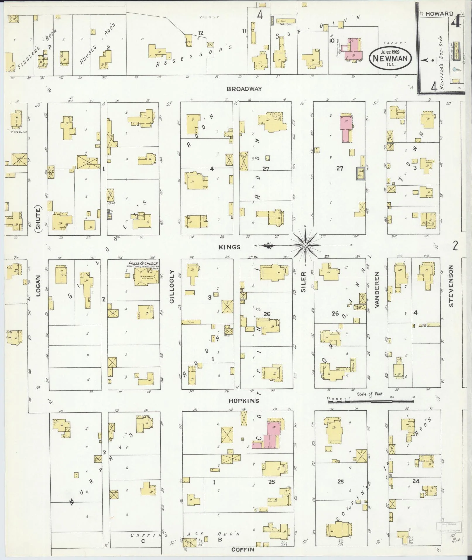
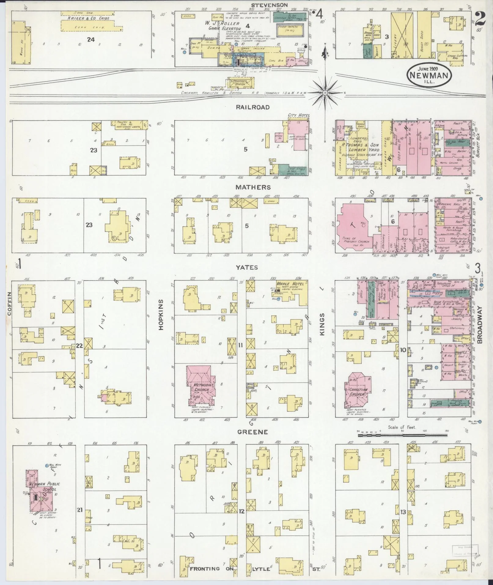
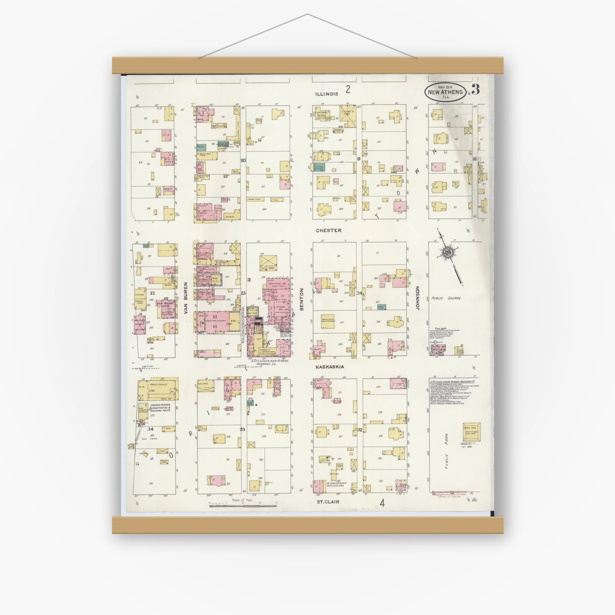
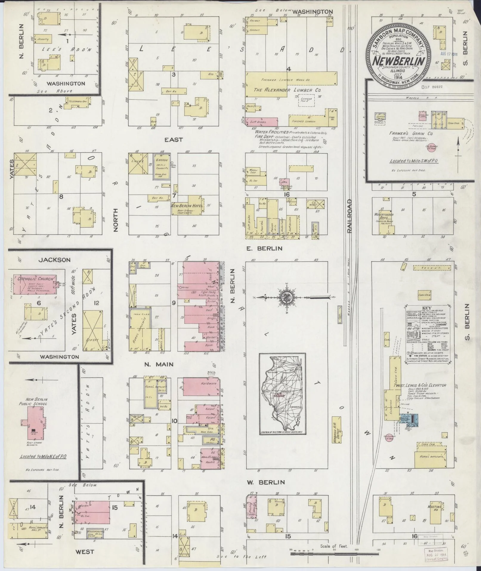
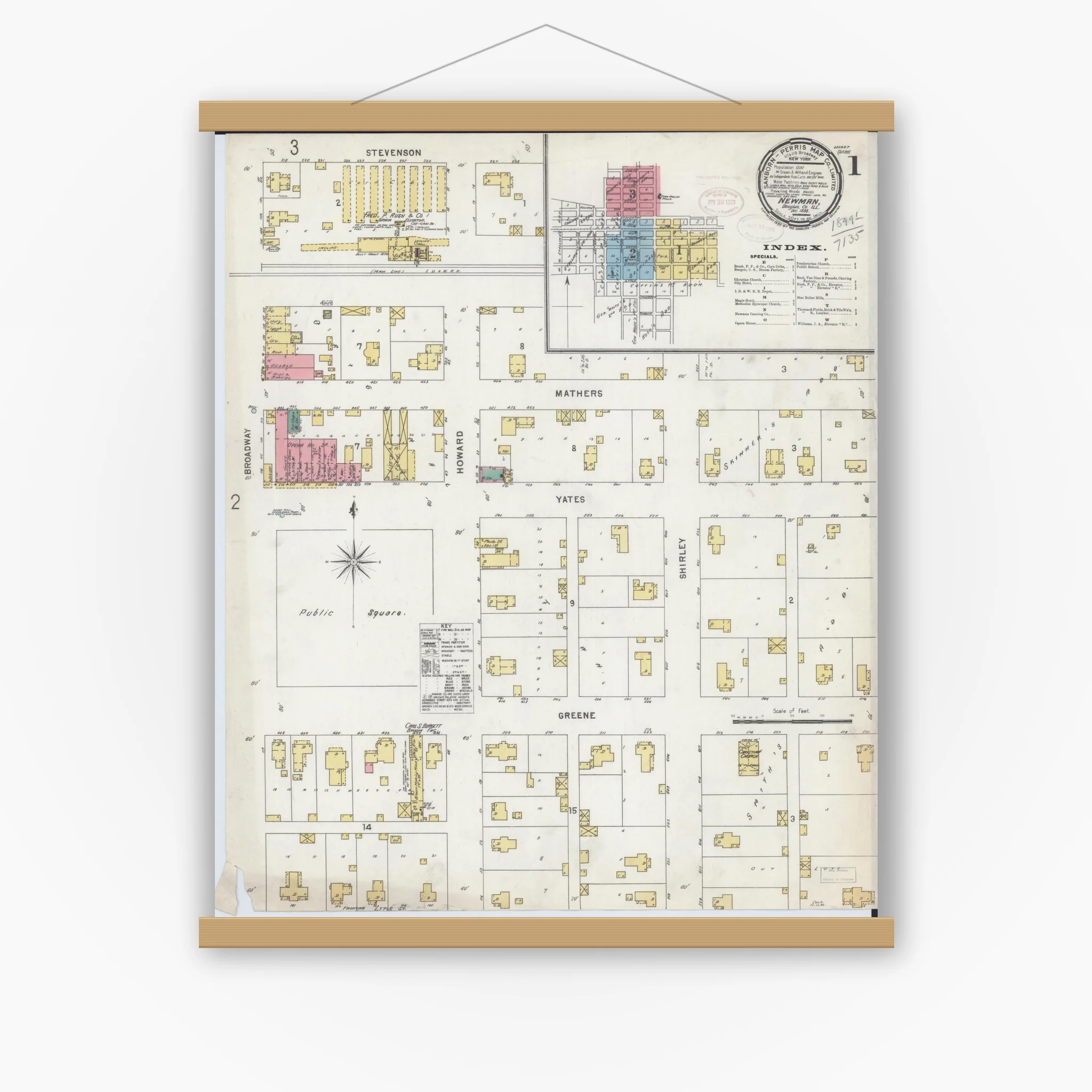
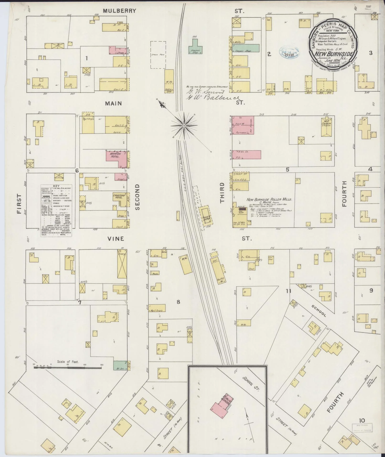
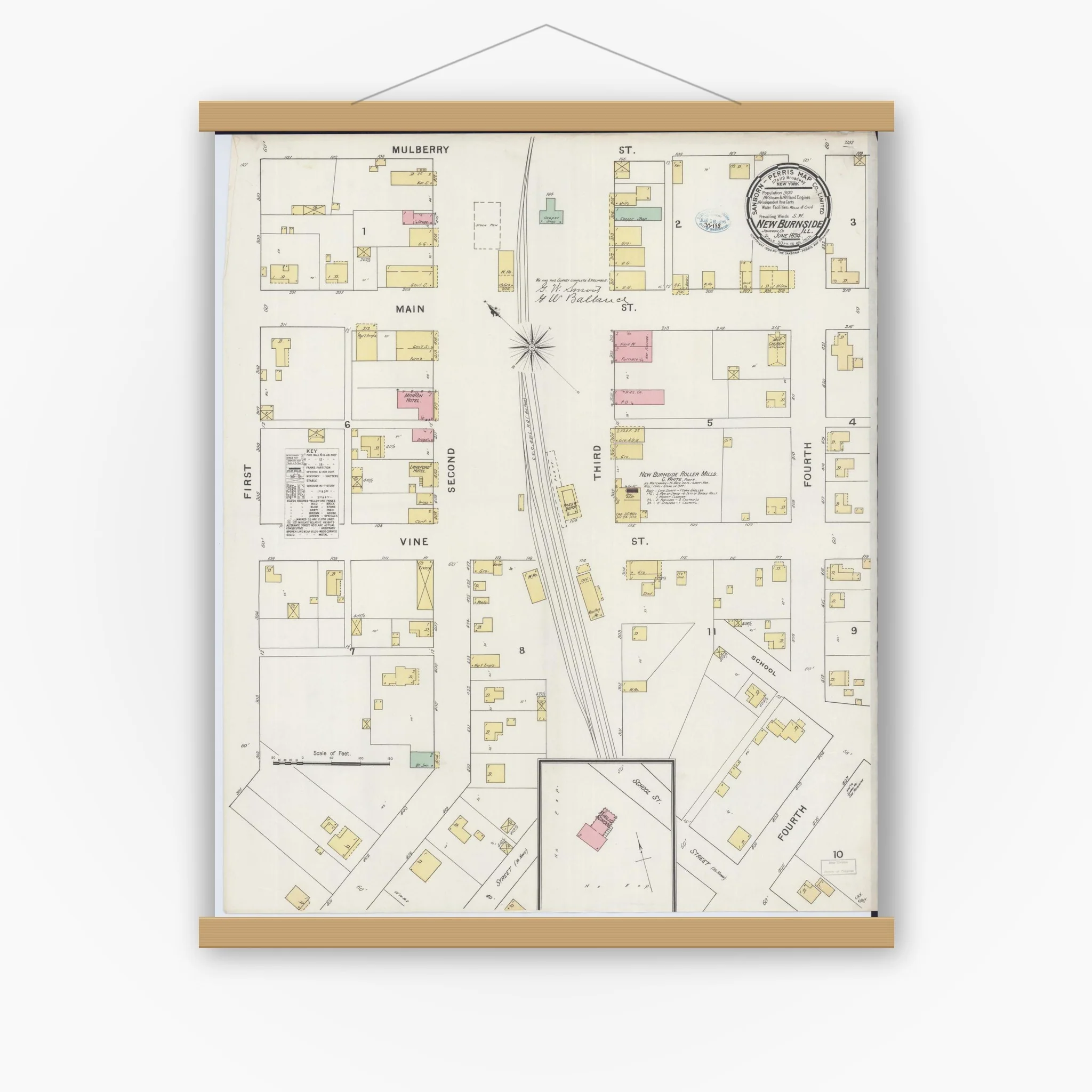
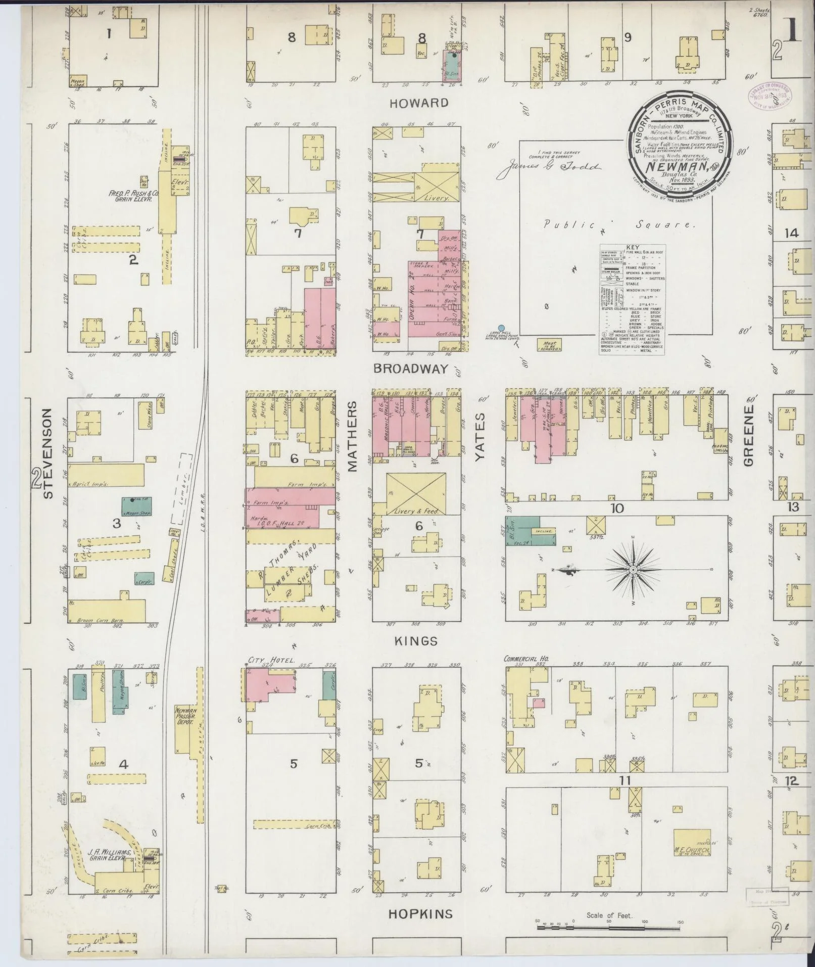
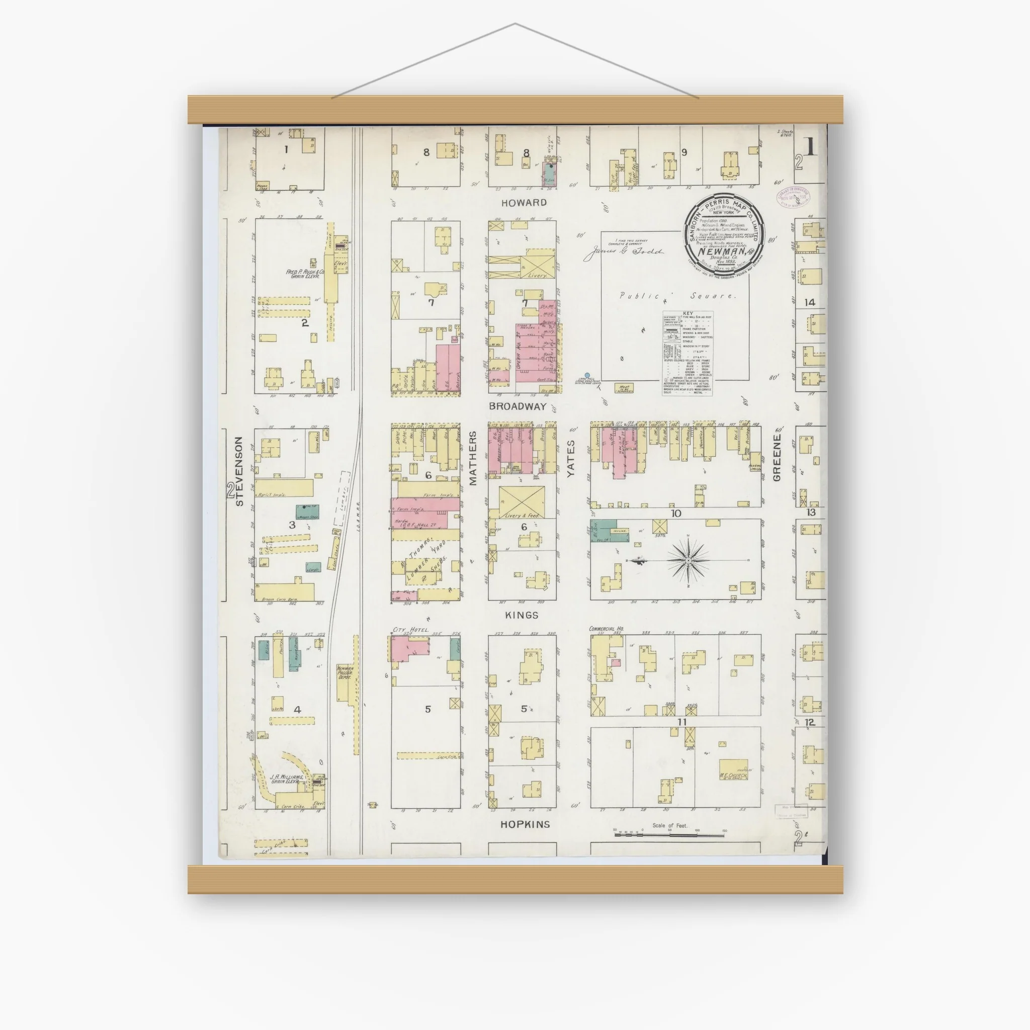
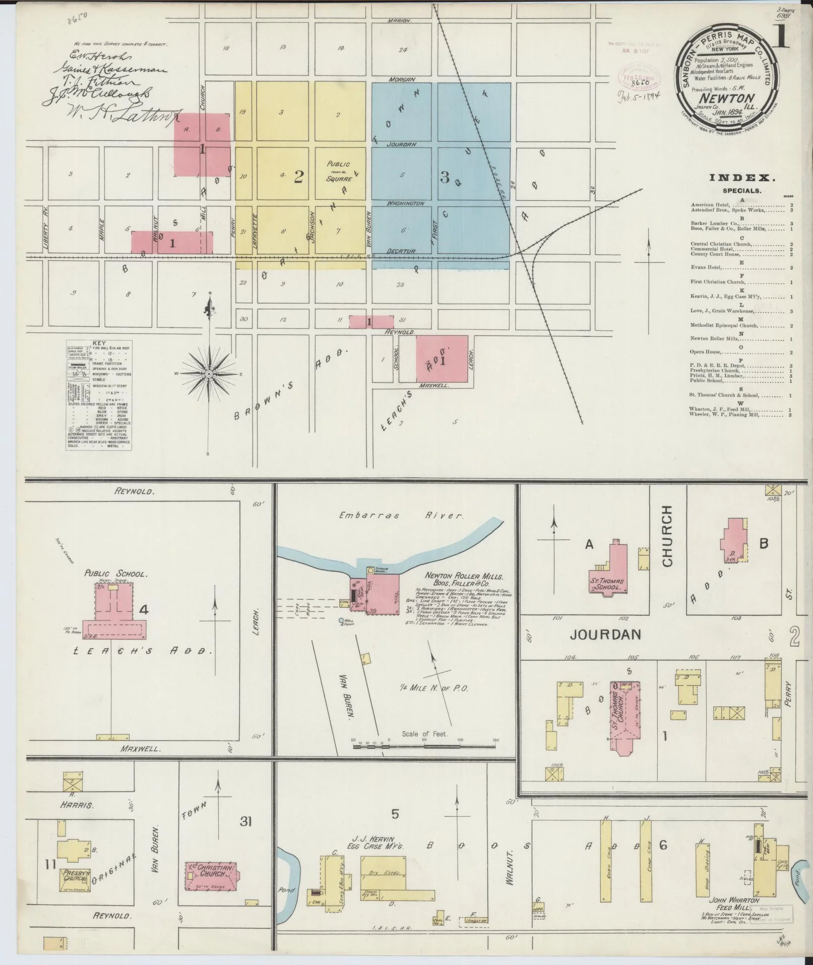
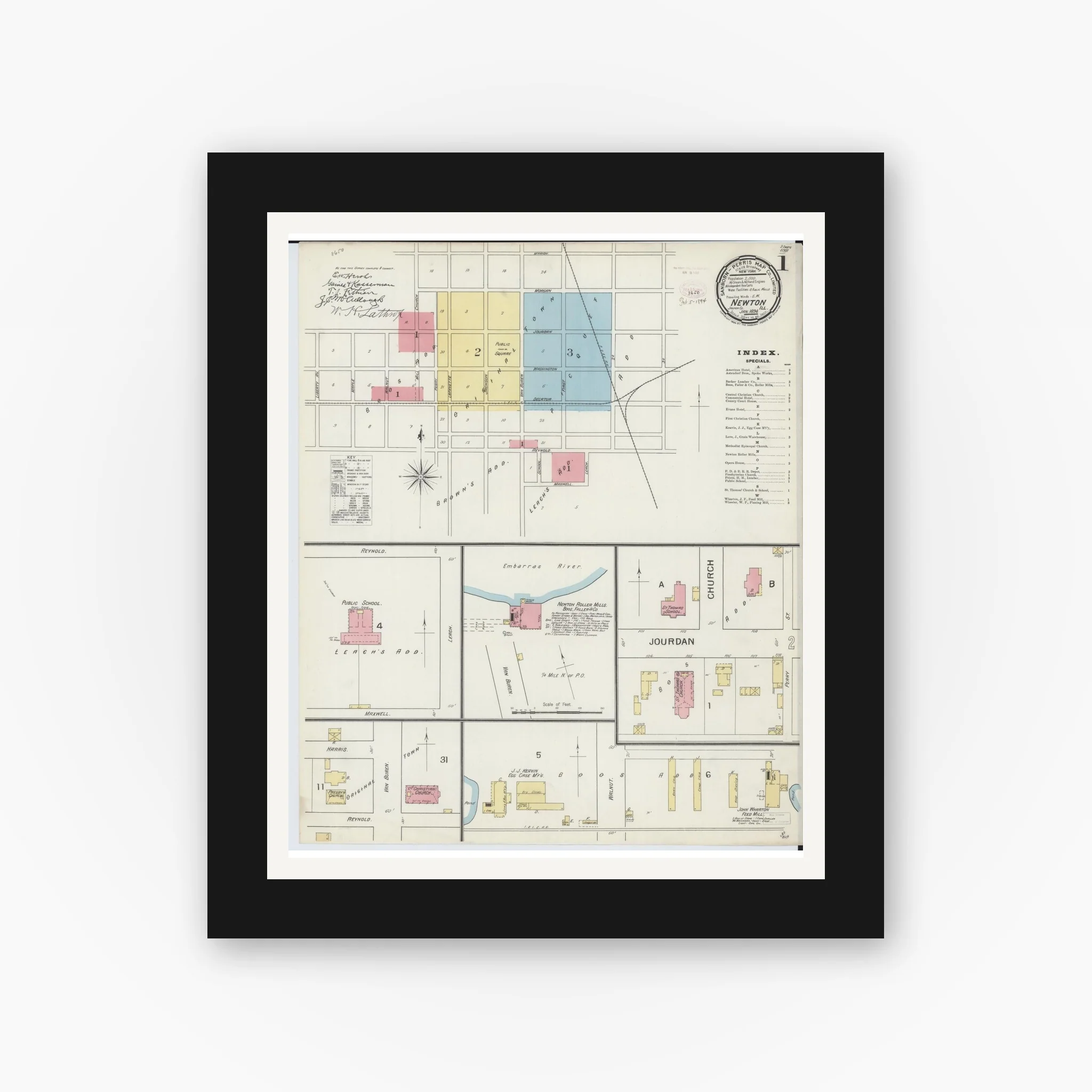
Sanborn Fire Insurance Map from Newton, Jasper County, Illinois (1894), Sheet #0001
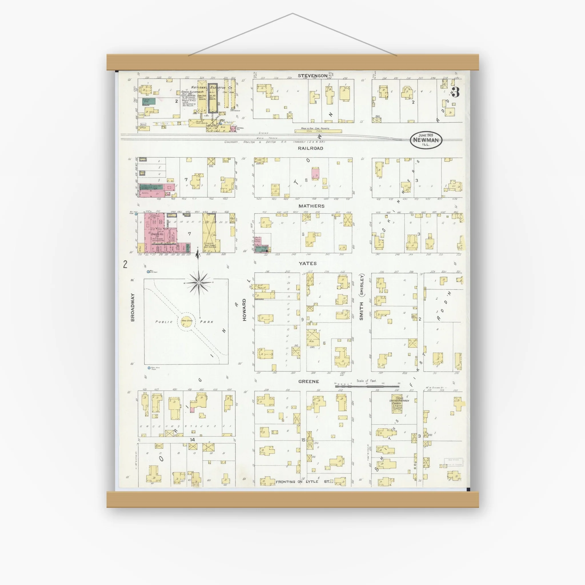
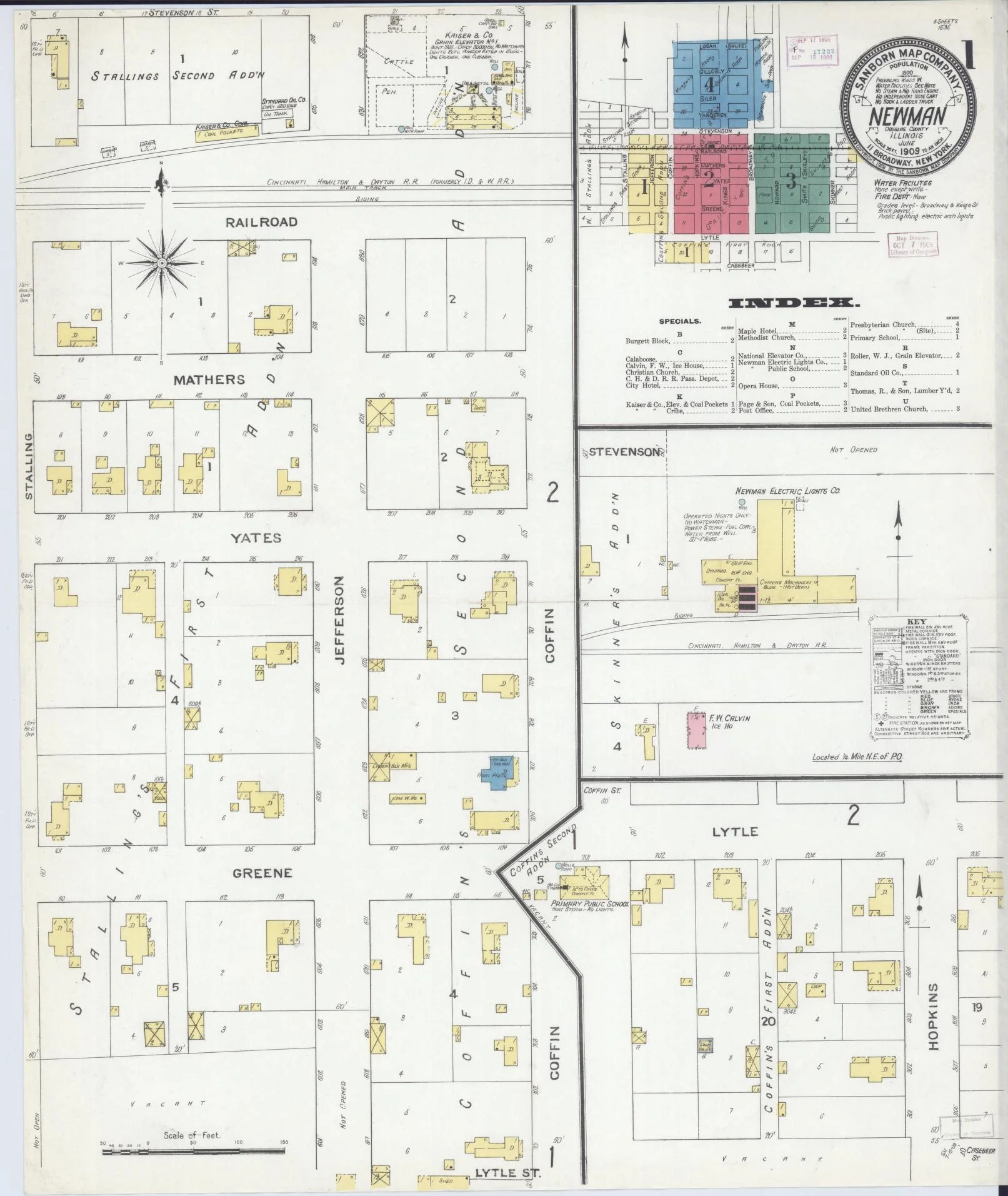
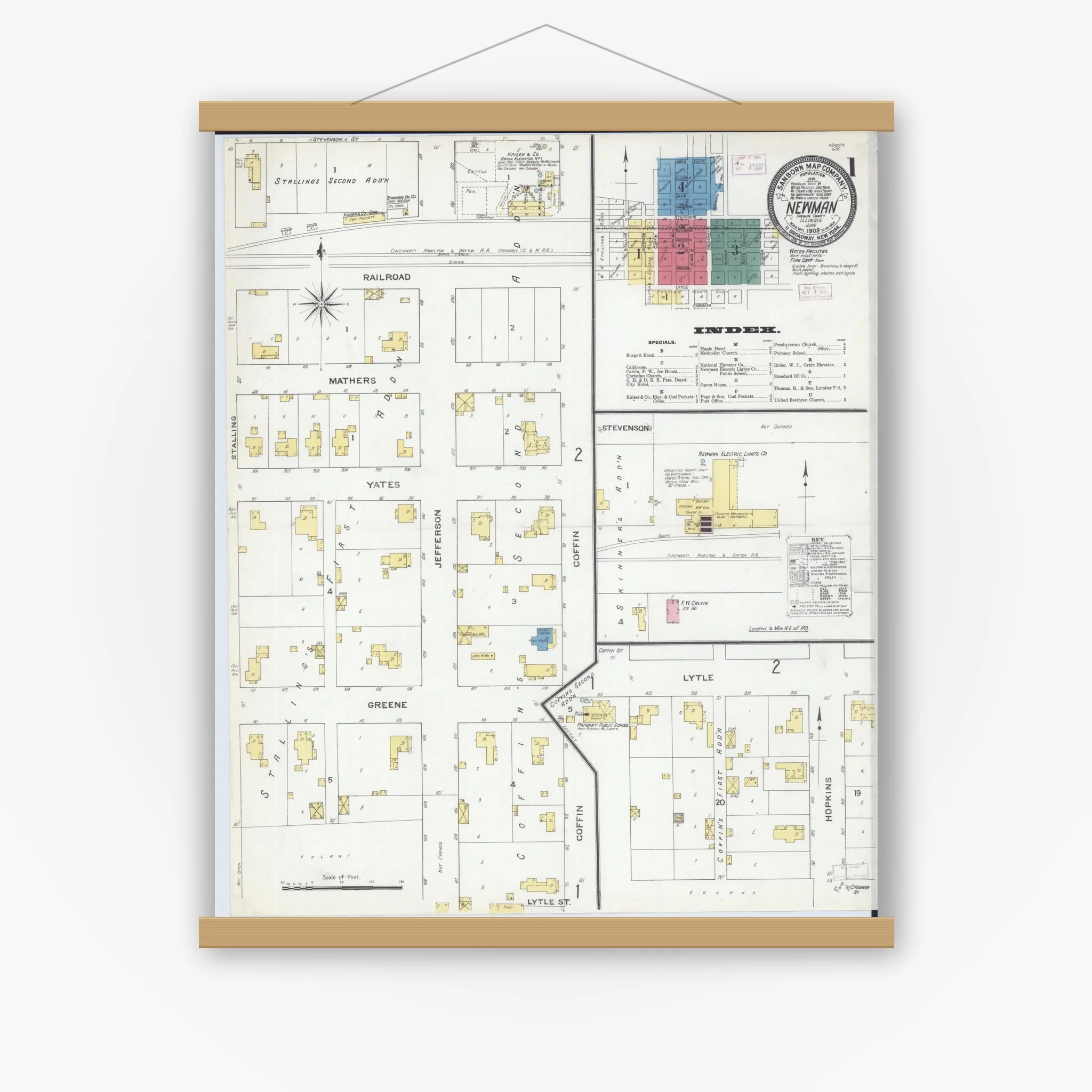
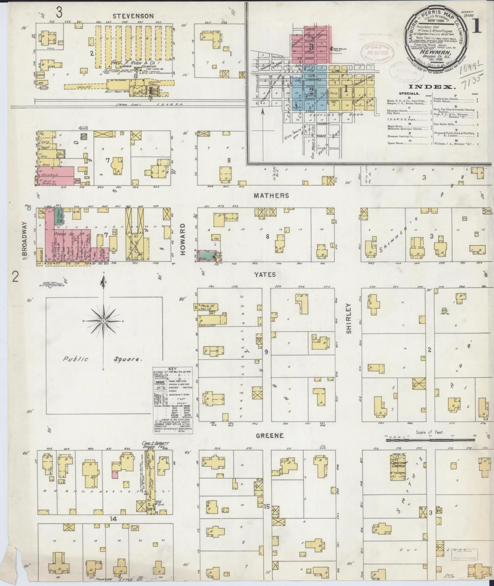
This is a high-resolution reproduction of a historic Sanborn fire insurance map sheet published in 1894. It is part of our exclusive collection of old maps for sale - perfect for home decor, office decor, restaurant decor, lobby art, genealogy research, or meaningful gifts.
Collectors often ask, 'where can I buy Sanborn maps?' Our shop makes it easy - this Illinois map is printed on premium paper and ships ready to frame.
Multi-sheet set: This listing is Sheet #0001. Additional sheets (downtown, neighborhoods, industrial areas) may be available for the same title/year. View all sheets for this map set (1894).
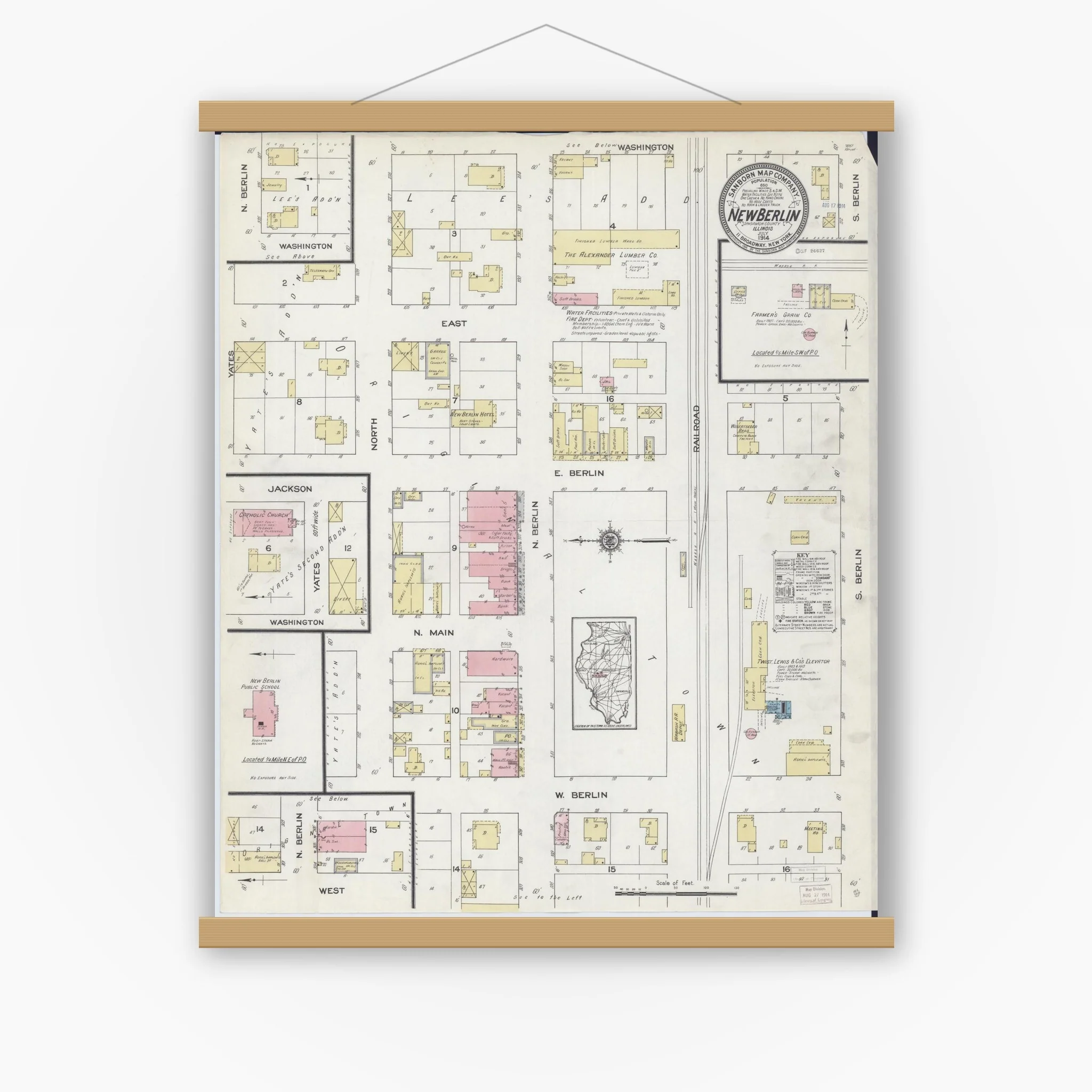
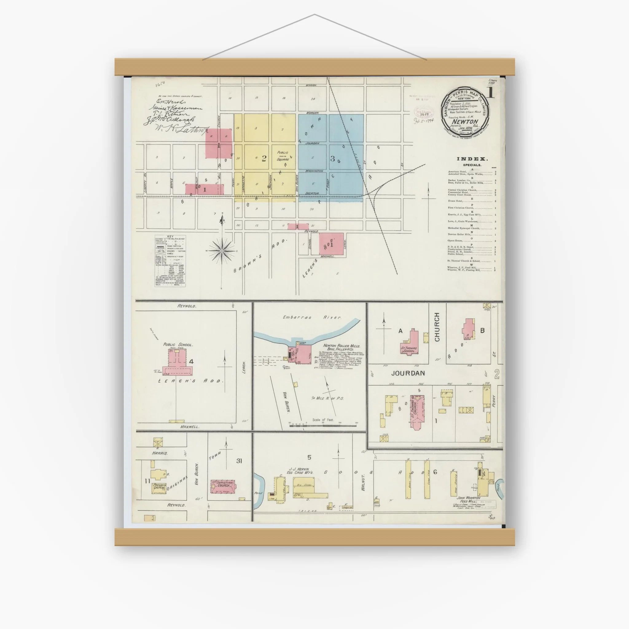
We preserve the original character - no tight cropping; tasteful borders as needed - so historic notes, stamps, and age marks may be visible. That authentic look is what makes our historic map prints so special.
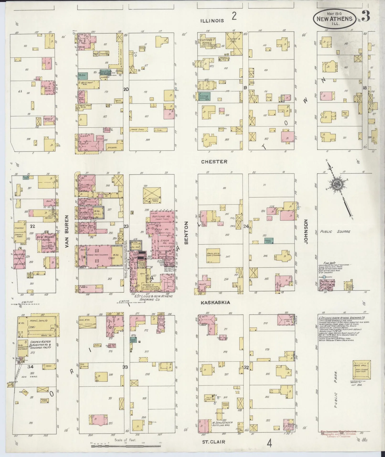
Map courtesy of the Library of Congress, Geography & Map Division.
Details & Craftsmanship
Every detail has been carefully considered to bring you the perfect product.
Details & Craftsmanship
Every detail has been carefully considered to bring you the perfect product.
Details & Craftsmanship
Every detail has been carefully considered to bring you the perfect product.
Description
Sanborn Fire Insurance Map from Newton, Jasper County, Illinois (1894), Sheet #0001
This is a high-resolution reproduction of a historic Sanborn fire insurance map sheet published in 1894. It is part of our exclusive collection of old maps for sale - perfect for home decor, office decor, restaurant decor, lobby art, genealogy research, or meaningful gifts.
Collectors often ask, 'where can I buy Sanborn maps?' Our shop makes it easy - this Illinois map is printed on premium paper and ships ready to frame.
Multi-sheet set: This listing is Sheet #0001. Additional sheets (downtown, neighborhoods, industrial areas) may be available for the same title/year. View all sheets for this map set (1894).
We preserve the original character - no tight cropping; tasteful borders as needed - so historic notes, stamps, and age marks may be visible. That authentic look is what makes our historic map prints so special.
Map courtesy of the Library of Congress, Geography & Map Division.